Between the River and the Tap

In Sri Lanka's Kelani River basin, an early-stage resilience project is looking at the work that happens before disruption reaches households: field testing, catchment mapping, water-quality data and earlier decisions at Ambatale and Biyagama.

Project team during the Ambatale Water Treatment Plant assessment, October 2025. Image: CDRI/UN-Habitat Sri Lanka

During dry periods, salinity intrusion at the intake can require temporary protective measures, including sandbag barriers. During floods, the problem changes. Turbidity can rise sharply, and polluted runoff can move towards the same supply system.

Both conditions affect the work of supplying drinking water to Colombo, Kotte and Kelaniya well before the problem would be visible at the tap.

They also point to a less visible part of water resilience: the interval between a change in the river and a decision by the people operating the system. That is the space the Safe and Resilient Water Supply for Western Cities project is trying to work in.

Supported by the Coalition for Disaster Resilient Infrastructure through the Infrastructure Resilience Accelerator Fund, and implemented with UN-HabitatSri Lanka’s National Water Supply and Drainage Board, the project focuses on the Ambatale and Biyagama water supply systems in the wider Colombo metropolitan region.

Its practical aim is to help an existing urban water system read changing catchment and water-quality conditions earlier, through field testing, risk mapping, real-time monitoring and a decision-support platform being developed for NWSDB and relevant agencies.

“The project aims to help agencies move from reacting to water quality and climate risks after they occur to identifying and responding to them earlier,” according to project information shared with The Future Atlas.

Raggahawatta Tributary, part of the Kelani River basin assessment, October 2025. Image: CDRI/UN-Habitat Sri Lanka

Where Water Risk Begins

The vulnerability of a water supply system does not sit only inside the treatment plant.

A tributary, canal, intake point, settlement edge or industrial zone can each contribute to the same chain of risk. Pollution from industrial areas, settlements and urban canals can move through the catchment before it reaches the plant. Heavy rain can raise turbidity. Drought can concentrate pollution and allow salinity to push upstream.

For operators, these are not distant climate risks. They translate into treatment demands, operating costs, temporary measures and decisions that have to be made before water quality becomes a wider supply issue.

The project is still in its early research and planning phase. Right now, the work is foundational: baseline data, monitoring locations, risk maps and the technical design for earlier warning.

Water-quality testing by UNI Consultants during project field assessments, October 2025. Image: CDRI/UN-Habitat Sri Lanka
Assessment of the current intake facility at Ambatale Water Treatment Plant, October 2025. Image: CDRI/UN-Habitat Sri Lanka

Mapping the Catchment

More than 50 water-testing locations have been identified across the Kelani River basin.

The sites were selected with reference to existing National Water Supply and Drainage Board and Central Environmental Authority monitoring locations, as well as the different pressures affecting water quality across the basin. Field teams have visited industrial hotspots along the river and its tributaries, polluted urban canals, informal settlements, flood-prone areas and locations vulnerable to salinity intrusion.

Field assessments, lab samples, hydrological and hydraulic modelling, and spatial analysis are being used to establish baseline conditions before the monitoring system is fully developed. The aim is to give the agencies responsible for water supply a clearer account of what is happening upstream.

One River, Two Supply Systems

Ambatale is one of Sri Lanka’s major water treatment facilities, supplying treated water to Colombo, Kotte Municipal Council areas and surrounding urban communities. Project information shared with The Future Atlas notes that it is currently supplying more water than its original design capacity.

Biyagama, on the opposite bank of the Kelani River, serves Kelaniya and surrounding areas, where industrial activity contributes to pollution pressure within the basin.

The project initially focused on Ambatale. During the inception phase, Biyagama was brought into the scope because it faces many of the same climate and water-quality risks.

The wider Colombo water supply system is shaped by river conditions, treatment capacity, urban growth, industrial activity, agency responsibilities and operating decisions. Ambatale and Biyagama sit within that chain.

Water-level gauge at the intake point, October 2025. Image: CDRI/UN-Habitat Sri Lanka

What Earlier Warning Could Change

Once the monitoring and decision-support system is in place, data on sudden increases in pollution, turbidity or salinity could be captured and shared with NWSDB and relevant agencies through the platform.

The purpose is to give operators more time to assess the risk, coordinate with authorities and make decisions at the intake to manage water quality and maintain supply.

According to information shared with The Future Atlas, “the exact alert thresholds and response protocols are being developed during the project’s implementation phase”, while the monitoring framework and technical specifications are still being finalised.

Here, climate resilience is not only a matter of physical protection. The monitoring work has a simpler aim: to know earlier where risks are emerging, how river conditions are shifting, and which parts of the system need to respond.

This is the back-of-house work of infrastructure adaptation: not a new structure, but the sampling plans, gauges, field visits, specifications, baseline data and agency coordination that help an existing system act before a problem arrives at the tap.

The Work Before the System is Finished

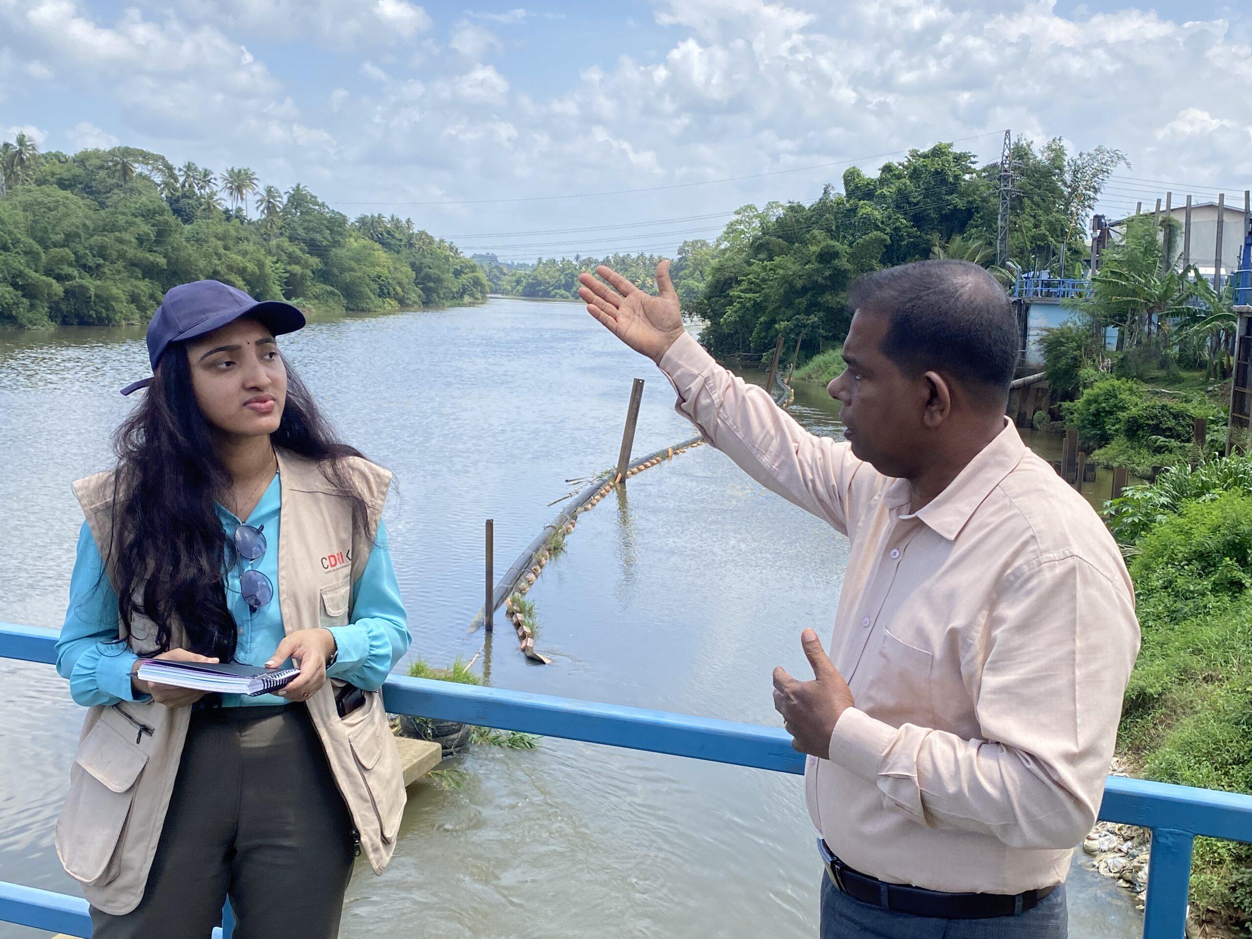
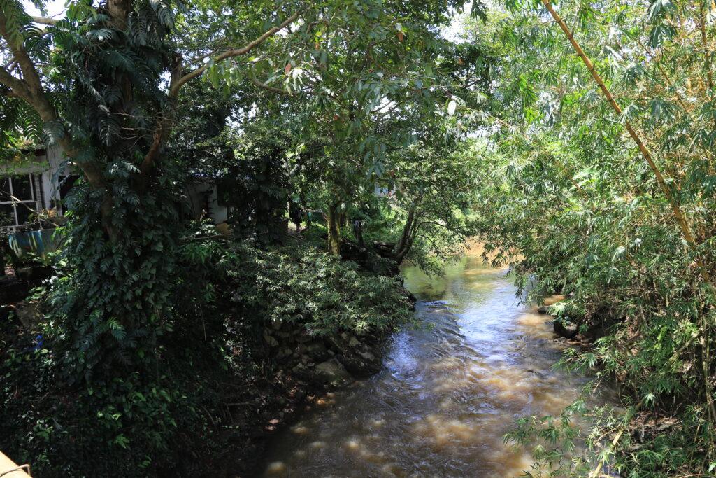
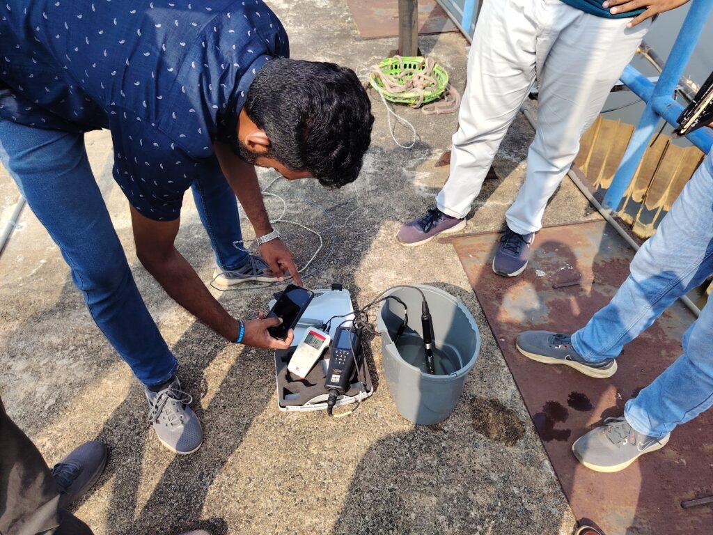
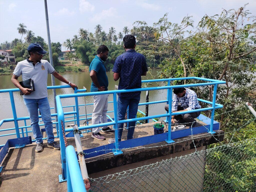
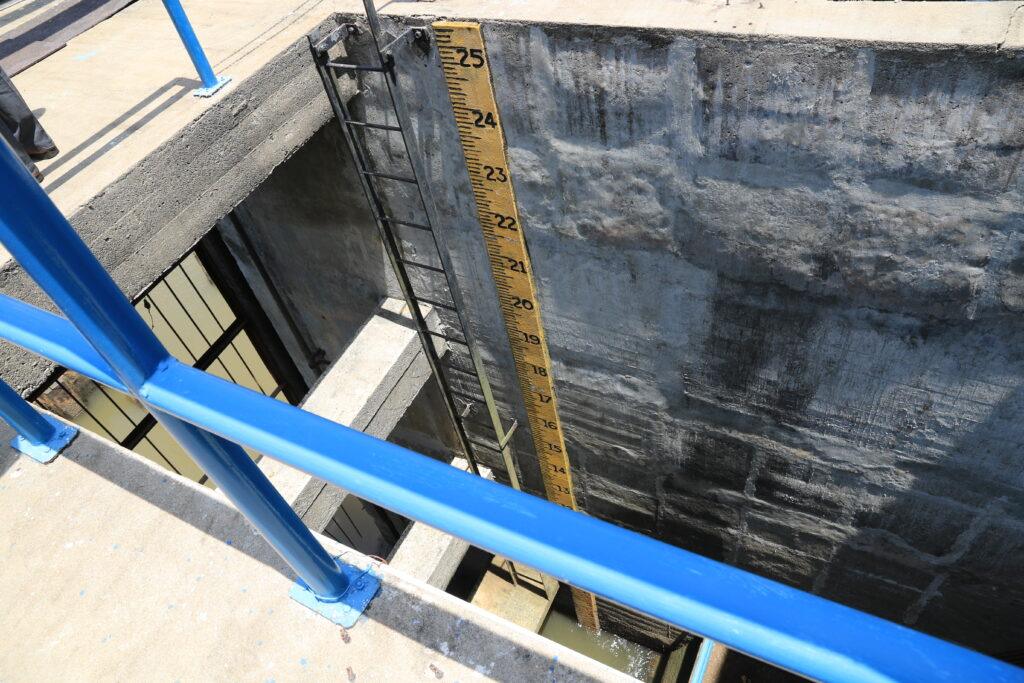
The field images from the project show resilience work in progress: sampling sites, riverbanks, water-quality testing equipment, intake infrastructure and a water-level gauge. They are useful because they show the work that comes before a system can read, measure and respond.

New infrastructure will still be needed. But existing systems will also need better ways to read changing conditions before they become emergencies.

In the Kelani River basin, that work is beginning in the less dramatic space between the river and the tap.

Editorial note: This story is based on public project information from CDRI and UN-Habitat Sri Lanka, additional information shared with The Future Atlas by the project communications team, and written responses to follow-up questions. Images: CDRI/UN-Habitat Sri Lanka.

与我们合作

联系表格